GPS On Benchmarks In Lake County OR
Donation protected
As part of an ongoing volunteer effort nationwide called "GPS On Benchmarks" ( http://www.ngs.noaa.gov/GPSonBM/ ),
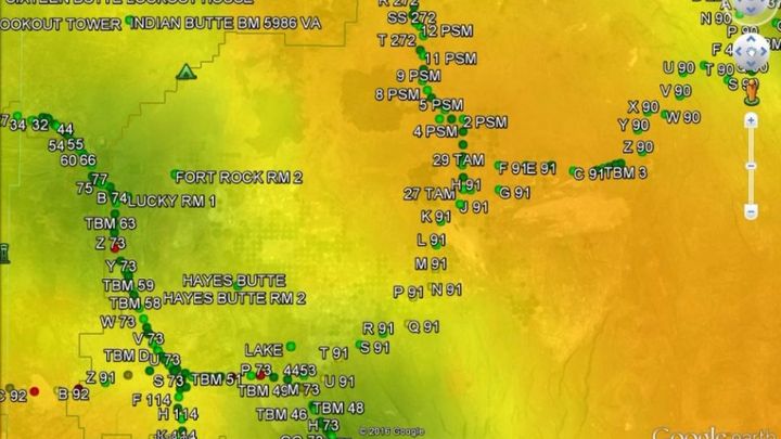
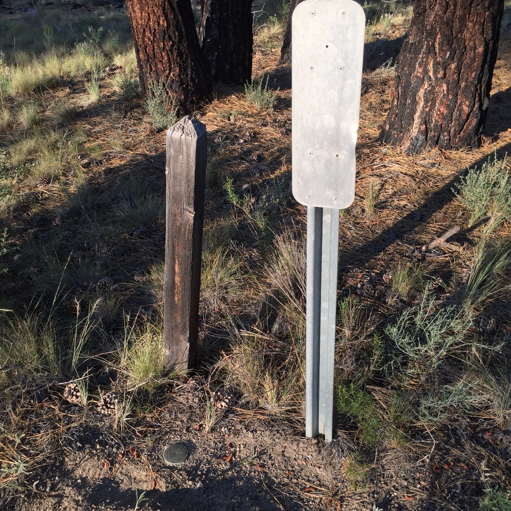
I am recovering NGS benchmarks in Christmas Valley and Fort Rock areas. Many have not been visited in decades and very few have ever been observed with survey-grade GPS. As I find them I am submitting recovery reports to the NGS, with new handheld GPS positions. The current data sheet positions for many of these benchmarks were scaled from a large area map and include an error estimate of plus or minus 180 meters, which is to say that if one entered the reported coordinates into one's handheld GPS, it is almost certain the monument will not be anywhere near the coordinate. My first step is to locate the benchmarks, from the location descriptions and the included ties rather than the coordinates.
So far I have recovered 10 benchmarks and am in the process of submitting recovery forms to the NGS for all of them.

I seek funding to occupy each monument with my X90-OPUS dual-frequency GPS receiver ( see http://x90gps.com/ ) for a minimum of four hours and submit that data to NGS's OPUS-Sharing, along with photographs and recovery notes, where all the point information is publicly available and can be used by other surveyors and mappers, and the datasheets will be updated with the much more precise GPS position and elevation.
In the long term, this data will be used by the NGS as scientific data for refining the geoid model and for the forthcoming readjustment of the North American Datum.
I am recovering NGS benchmarks in Christmas Valley and Fort Rock areas. Many have not been visited in decades and very few have ever been observed with survey-grade GPS. As I find them I am submitting recovery reports to the NGS, with new handheld GPS positions. The current data sheet positions for many of these benchmarks were scaled from a large area map and include an error estimate of plus or minus 180 meters, which is to say that if one entered the reported coordinates into one's handheld GPS, it is almost certain the monument will not be anywhere near the coordinate. My first step is to locate the benchmarks, from the location descriptions and the included ties rather than the coordinates.
So far I have recovered 10 benchmarks and am in the process of submitting recovery forms to the NGS for all of them.
I seek funding to occupy each monument with my X90-OPUS dual-frequency GPS receiver ( see http://x90gps.com/ ) for a minimum of four hours and submit that data to NGS's OPUS-Sharing, along with photographs and recovery notes, where all the point information is publicly available and can be used by other surveyors and mappers, and the datasheets will be updated with the much more precise GPS position and elevation.
In the long term, this data will be used by the NGS as scientific data for refining the geoid model and for the forthcoming readjustment of the North American Datum.
Organizer
James Ray
Organizer
Christmas Valley, OR