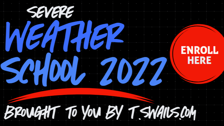
TSwails Severe Weather School 2022
Donation protected
SEVERE WEATHER SCHOOL WITH EMMY AWARD WINNING METEOROLOGIST TERRY SWAILS AND A NUMBER OF ESTEEMED GUESTS
When: Saturday, February 5th, 2022
Time: 12:00 to 5:00 P.M.
Where: Holiday Inn Express in Le Claire, Iowa (1201 Canal Shore Dr. SW, Le Claire, IA 52753)
Cost: $99 dollars per person
TSwails.com is offering a very special opportunity for you to learn first-hand the ins and outs of severe weather forecasting with one of the most experienced meteorologists in the country and a talented team of experts.
This is a unique one-of-a-kind chance for you to forecast right along with Terry Swails. He’s teaching class with his interactive program called SEVERE WEATHER SCHOOL. The opening bell rings this February and you can be a member of the 2022 graduating class. The one-day forecasting session for weather enthusiasts will be held in the Holiday Inn Express in Le Claire, Iowa. It's situated on the Mississippi just off the I-80 exit. Address: 1201 Canal Shore Dr. SW, Le Claire, IA 52753
This is not your typical run-of-the-mill school. There will be no tests, but Terry, and TV meteorologists' Nick Stewart (Emmy award winner) and Rebecca Kopelman of KGAN TV will cram your head with so much knowledge, it’ll be spinning like an EF5. So you want to know the essential online sites to use for models, radar, and basic severe weather tools? DONE! You want to understand the structure of models and the role they play? DONE! You want to be able to construct forecasts from the ground up? DONE! Rest assured; we'll take you inside the world of extreme weather to a wonderous place you will never have to leave.
This is not your typical run-of-the-mill school. There will be no tests, but Terry, and TV meteorologists' Nick Stewart (Emmy award winner) and Rebecca Kopelman of KGAN TV will cram your head with so much knowledge, it’ll be spinning like an EF5. So you want to know the essential online sites to use for models, radar, and basic severe weather tools? DONE! You want to understand the structure of models and the role they play? DONE! You want to be able to construct forecasts from the ground up? DONE! Rest assured; we'll take you inside the world of extreme weather to a wonderous place you will never have to leave.
Weather School will be presented in a classroom format where you will have the ability to ask questions, and dig deep. Aside from the basics of data acquisition and model analysis, a heavy emphasis will be placed on severe weather, and how it's forecast by the big dog himself, T. Swails. With 45 years of experience and an uncanny ability to break the science down, you’ll open the door to forecasting like never before.
We'll also take an in depth look at significant regional severe weather climatology with a special emphasis on violent tornadoes. Terry will highlight the region's worst twisters, and discuss trends he’s found in his research. His presentation also includes captivating videos, and stories that will have you on the edge of your seat. A SPECIAL NEW addition to the agenda is a deep dive into the 225 mile long tornado which leveled Mayfield, Kentucky and numerous other towns in its path. It likely will be the longest tornado in United States history and we will explore its causes and similarities to the 1925 tri-state tornado which killed over 700 people. We'll also go inside the historic and deadly tornadoes that struck Belmond, Iowa in 1966, Charles City, Iowa 1968, Parkersburg, Iowa 2008, Joplin, Missouri 2011, and Washington, Illinois in 2013.
Along with the head master T. Swails himself, long-time NWS forecaster John Haase, and TV meteorologists Rebecca Kopelman and Nick Stewart will be there to lend their knowledge and experience to the discussion. It will be fun, informative, and factual! This is the day for you to see, feel, and experience what it’s like to be in the driver's seat with all the tools of a meteorologist.
The session will be held February 5th in the Quad Cities, and will last from noon until 5:00pm. It will be held at the Holiday Inn Express in Le Claire, Iowa. It's situated on the Mississippi just off the I-80 exit. Address: 1201 Canal Shore Dr. SW, Le Claire, IA 52753 We have room for 50 the cost is $99 dollars per person. Refreshments will be provided. Seating is limited and a reservation with pre-payment is required. Sorry, no refunds. If there’s enough interest, a second session will be added later in March. The Agenda is listed below.
- The 2022 program features an impressive roster of severe weather scientists and forecasters. Here is the list of speakers and their talks for the Saturday, February 5th event:
2022 WEATHER SCHOOL AGENDA
WELCOME AND INTRODUCTION
Purpose: To help weather enthusiasts understand the basics of severe weather forecasting and apply the knowledge and techniques learned to construct personal forecasts.
Session 1: DATA ACQUISITION
The essential on-line sites for models, observations, satellite and radar images, and general weather data.
Session 2: MODEL ANALYSIS
The art and science of model analysis and interpretation. Understanding and utilizing model output and its value in severe weather forecasting. Model options and choices. What to use and when! Locating, learning, and knowing what’s essential to make a reliable forecast.
Session 3: MESOCYCLONES AND SEVERE WEATHER
In this session you will learn about the development and distinctions associated with tornadoes, derechos, and mesoscale convective events. You'll learn about instability, and critical interactions involving moisture, heating, and forcing. We'll tackle the topic of soundings, and lay out all the ingredients required to create a severe weather set-up.
Radar is a critical tool in real time severe weather events, and we'll show you the key features to look for regarding tell-tale radar signatures.
SESSION 4: TORNADO FORECASTING HISTORY
SPC forecaster Steven Weiss discusses the history of tornado forecasting and the role of surface analysis in the advancement of tornado forecasting.
SESSION 5: MAKING A SEVERE WEATHER FORECAST FROM MODEL GUIDANCE
SPC forecaster Steven Weiss discusses how surface mesoanalysis is done, its role in severe weather forecasting, and how to use various data sources to help identify surface boundaries. A simulation of the basic process using model output from the 2011 super outbreak which produced 360 confirmed tornadoes and killed 350 people
BREAK: A 15 MINUTE RECESS TO ENJOY SNACKS AND REFRESHMENTS
SESSION 6: IOWA’S INLAND HURRICANE, THE 2020 SUPER DERECHO AND THE 2021 DECEMBER DERECHO
Nick Stewart (Emmy Award winning television meteorologist at KGAN-TV).
Nick will discuss the evolution of the 2020 Derecho which wreaked havoc on a large swath of Iowa and Illinois as it barreled east in August 2020. Nick addresses the challenges of forecasting, and warning the event which is labeled the worst thunderstorm in U.S. history. Nick will also discuss the NWS role in determining the 140 mph wind gusts which devastated Cedar Rapids claiming 65% of the tree canopy. Terry follows that up with an in depth look at the only known December derecho in U.S. History. The serial derecho set an all-time Iowa record for tornadoes in a single day with at least 42 confirmed just 10 days before Christmas
SESSION 7: VIOLENT TORNADOES OF THE MIDWEST
Terry Swails (Emmy Award winning television meteorologist and lead forecaster at TSwails.com). Terry will highlight the areas worst tornadoes and discuss trends he’s found in his research. His presentation also includes some captivating videos and stories that will have you on the edge of your seat.
SESSION 8: THE TWIN CHARLES CITY AND OELWEIN EF5 TORNADOES OF 1968
John Haase (Meteorologist National Weather Service Quad Cities).
John tackles the epic May 15, 1968 tornado outbreak that generated two deadly EF5 tornadoes which battered Charles City and Oelwein, Iowa. The rare EF5 twisters struck within 10 minutes of one another and were only 60 miles apart. There is no other history of two EF5 storms occurring at the same time and day in Iowa. The tornadoes killed 18, and injured another 619 others. Historically this is considered to be one of Iowa’s worst tornado outbreaks.
SESSION 9: THE DECEMBER 10TH MAYFIELD KENTUCKY TORNADO
John Haase (Meteorologist National Weather Service Quad Cities).
On December 10, 2021, a violent long tracked tornado barreled across several state producing a 225 mile long path of destruction leveling the town of Mayfield, Kentucky. It is believed to be the longest tornado in United States history. John goes inside this historic tornado and explores its causes and similarities to the 1925 tri-state tornado which killed over 700. Just as remarkable is the fact the outbreak came in the month of December and the strong tornadoes occurred after dark,
SESSION 10: THE WASHINGTON, ILLINOIS EF4 TORNADO AND THE RARE HIGH RISK SPC OUTLOOK NOVEMBER 17th. (Violent Midwest twisters “can” happen in the fall and winter).
Nick Stewart (Emmy Award winning television meteorologist at KGAN-TV)
Nick takes an in-depth look at this explosive day November 17th, 2013. Day dawned with a rare high risk SPC outlook that quickly led to a PDS tornado watch by mid-morning. By 11:00 A.M. the worst and deadliest November tornado in Illinois history was dealing out 190 mph winds. Nick discusses the unique nature of the event and the urgency in the warnings put out that undoubtedly saved many lives. In all, 73 tornadoes touched down during the outbreak and many were long tracked and violent.
SESSION 11: THE JOPLIN SUPER TORNADO (160 DEATHS IN 2011)
Terry Swails speaks to the power of this monster, and shows two of the most compelling videos ever taken of such a violent storm. They reveal the rapid formation of the mile wide funnel and depict the ferocity that makes it the deadliest tornado in modern history. This is some heavy-duty video that is absolutely riveting.
SESSION 12: THE PARKERSBURG EF5 May 25th, 2008
John Haase (Meteorologist National Weather Service Quad Cities).
May 25th, 2008 the first EF5 tornado to touch down in eastern Iowa in 40 years roared through the southern half of Parkesburg just before 5:00 P.M. Extreme winds of 205 mph caused extreme devastation as the storm carved a 43 mile path narrowly missing Cedar Falls and Waterloo. Despite excellent watches and warnings, the sheer power of the storm killed 9 and injured 70. Hear the story of the day from John’s meteorological perspective.
QUESTION AND ANSWER SESSION
An open period for attendees to ask questions regarding relevant topics or issues discussed during the day.
GIVE THE GIFT OF WEATHER.
This might be the perfect gift for that hard to buy for person this Christmas. Along with a SEVERE WEATHER SCHOOL admittance voucher, TSwails will send a personal holiday greeting that you can print, wrap, and give to your special weather enthusiast. It's the gift of weather with the TSwails touch.
Organizer
Terry Swails
Organizer
Le Claire, IA