A free digital map of the world's forests
Donation protected
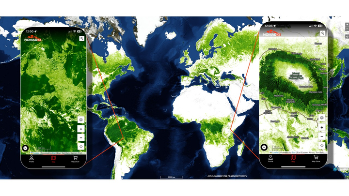
Imagine a world where anyone—scientists, conservationists, nature lovers, and anyone else—can explore Earth’s forests with the same scope and detail as NASA scientists studying the biosphere. Over the past 15 years, my research lab has developed the world's highest-resolution, most comprehensive digital map of global tree cover. It has answered how much forest there is on Earth, where it is, and where it's being lost to deforestation, wildfires, and urban development (not to mention the places it's growing back).
However, it has only been available to government agencies, big businesses, and the largest nonprofit research and conservation organizations who can afford it.
I want to make the same level of information available to every person on Earth.
To do it, I am going to update the terraPulse Global Tree Cover dataset for 2025 with new algorithms and new satellite images, and I'm going to make it available for free to everyone on the NomadIQ mobile app.
Organizer
Joe Sexton
Organizer
College Park, MD