Satellite Communications
Donation protected
Q: Is it possible to communicate with satellites orbiting high above the earth directly from our classroom at The New School Montessori Center?
A: YES!
NOAA's Geostationary and Polar-Orbiting Weather Satellites
Operating the country's system of environmental satellites is one of the major responsibilities of the National Oceanic and Atmospheric Administration's (NOAA) National Environmental Satellite, Data, and Information Service (NESDIS). NESDIS operates the satellites and manages the processing and distribution of the millions of bits of data and images these satellites produce daily. The primary customer is NOAA's National Weather Service, which uses satellite data to create forecasts for the public, television, radio, and weather advisory services. Satellite information is also shared with various federal agencies (the Departments of Agriculture, Interior, Defense, and Transportation), with other countries (Japan, India, and Russia, and members of the European Space Agency (ESA) and the United Kingdom Meteorological Office), and with the private sector.
How does this project work?
The NOAA APT weather satellites broadcast their signals at about 137 MHz, and their signals are also right hand circularly polarized (RHCP), which means you will need a right hand circularly polarized antenna to properly receive the signals. We could, in theory, make a quadrifilar antenna by hand, but the margin of error for this delicate receive is huge.
Every day, multiple NOAA weather satellites pass above us. Each NOAA weather satellite broadcasts an Automatic Picture Transmission (APT) signal which contains live weather images. The RTL-SDR dongle combined with a good antenna, SDR#, and a decoding program can be used to download and display these live images several times a day.
`
Satellite antennas are also designed to receive best from signals coming from the sky. The NOAA satellites only pass overhead at certain times of the day, broadcasting a signal. These signals appear at around ~137 MHz, and only when a satellite is passing overhead. Each satellite has a different frequency. Currently only NOAA satellites 15, 18 and 19 are operational; their frequencies are shown below.
NOAA 15 – 137.6200 MHz
NOAA 18 – 137.9125 MHz
NOAA 19 – 137.1000 MHz
What will we do with our materials?
We will set up our antenna, our receiver, and our software. Once this is completed, we will test the system. We can experiment with various positions of the antenna for the best reception. While NOAA 19 will be our primary focus, we can also use our equipment to receive packets from other satellites. The data we receive will be the same data meteorologists and space agencies across the world receive. For younger students, the fundamentals of space, weather, and radio waves can be explored as works in the classroom as a precursor for viewing the data received from NOAA’s fleet.
Project Materials List
Description
Cost and Source
QUADRIFILAR HELIX ANTENNA
$219.95 | www.nationalrf.com
R303-137 RECEIVER
$259.00 | hamtronics.com
LMR-400 ULTRAFLEX COAX (50”)
$65.99 x 2 = $131.98 | amaeturradiosupplies.com
A1 TUNING TOOL
$6.00 | hamtronics.com
RCA PLUG AND CABLE
$2.00 | hamtronics.com
A40 115VAC/12Vdc POWER ADAPTER
$10.00 | hamtronics.com
PROJECT TOTAL:
$628.93
Amateur Radio Across the Curriculum
In Our Montessori Classrooms
MATHEMATICS
metric system conversions
24-hour clock
estimating
measuring distances
using formulas
the horizon and degrees of measurement
calculating line loss in coaxial cable
GEOGRAPHY & WORLD STUDIES
using maps and the globe
international collaboration for common good
international date line
the equator and the poles
longitude and latitude
world time zones
topography
continents of the world
PHYSICS & SCIENCE
radio waves
the electromagnetic spectrum
basic electrical principles
meteorology
science careers
satellites
layers of the atmosphere
orbits and gravitational pull
azimuth and altitude
scientific method
hertz and ISU
UHF, VHF, HF
scientific instruments
innovations in science and technology
antenna design
solar panels
history of space science
coaxial cable
conductivity
COMMUNICATIONS & LANGUAGE ARTS
emergency communications
forecasting
Greek and Latin roots
etymology
note-taking skills
SKYWARN
COMPUTER SCIENCE
collecting data
compiling and analyzing data
packet radio (computer)
software and its purposes
interpreting data
decoding telemetry
live Internet feeds
satellite tracking
computer graphics
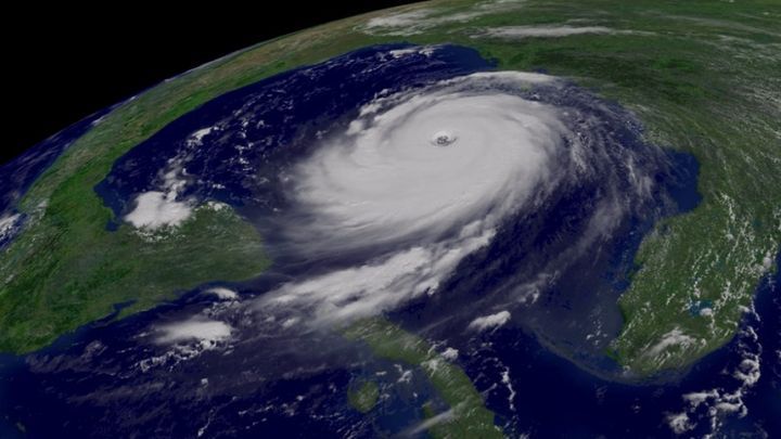
example of NOAA weather satellite image
This project was demonstrated at the ARRL Teachers Institute that I attended in Newington, Connecticut, in July. It was absolutely mesmerizing. I wanted to bring this wonder back home to the students here at The New School as a part of our radio science curriculum.
I look forward to doing great things together. The support that you provide is invaluable. Please stop by the UE classroom to visit our school’s ham shack.
With warmest regards,
Nancy Butterfield
KM4KUT
Montessori Intern, Upper Elementary
Instructor, Amateur Radio Club
A: YES!
NOAA's Geostationary and Polar-Orbiting Weather Satellites
Operating the country's system of environmental satellites is one of the major responsibilities of the National Oceanic and Atmospheric Administration's (NOAA) National Environmental Satellite, Data, and Information Service (NESDIS). NESDIS operates the satellites and manages the processing and distribution of the millions of bits of data and images these satellites produce daily. The primary customer is NOAA's National Weather Service, which uses satellite data to create forecasts for the public, television, radio, and weather advisory services. Satellite information is also shared with various federal agencies (the Departments of Agriculture, Interior, Defense, and Transportation), with other countries (Japan, India, and Russia, and members of the European Space Agency (ESA) and the United Kingdom Meteorological Office), and with the private sector.
How does this project work?
The NOAA APT weather satellites broadcast their signals at about 137 MHz, and their signals are also right hand circularly polarized (RHCP), which means you will need a right hand circularly polarized antenna to properly receive the signals. We could, in theory, make a quadrifilar antenna by hand, but the margin of error for this delicate receive is huge.
Every day, multiple NOAA weather satellites pass above us. Each NOAA weather satellite broadcasts an Automatic Picture Transmission (APT) signal which contains live weather images. The RTL-SDR dongle combined with a good antenna, SDR#, and a decoding program can be used to download and display these live images several times a day.
`
Satellite antennas are also designed to receive best from signals coming from the sky. The NOAA satellites only pass overhead at certain times of the day, broadcasting a signal. These signals appear at around ~137 MHz, and only when a satellite is passing overhead. Each satellite has a different frequency. Currently only NOAA satellites 15, 18 and 19 are operational; their frequencies are shown below.
NOAA 15 – 137.6200 MHz
NOAA 18 – 137.9125 MHz
NOAA 19 – 137.1000 MHz
What will we do with our materials?
We will set up our antenna, our receiver, and our software. Once this is completed, we will test the system. We can experiment with various positions of the antenna for the best reception. While NOAA 19 will be our primary focus, we can also use our equipment to receive packets from other satellites. The data we receive will be the same data meteorologists and space agencies across the world receive. For younger students, the fundamentals of space, weather, and radio waves can be explored as works in the classroom as a precursor for viewing the data received from NOAA’s fleet.
Project Materials List
Description
Cost and Source
QUADRIFILAR HELIX ANTENNA
$219.95 | www.nationalrf.com
R303-137 RECEIVER
$259.00 | hamtronics.com
LMR-400 ULTRAFLEX COAX (50”)
$65.99 x 2 = $131.98 | amaeturradiosupplies.com
A1 TUNING TOOL
$6.00 | hamtronics.com
RCA PLUG AND CABLE
$2.00 | hamtronics.com
A40 115VAC/12Vdc POWER ADAPTER
$10.00 | hamtronics.com
PROJECT TOTAL:
$628.93
Amateur Radio Across the Curriculum
In Our Montessori Classrooms
MATHEMATICS
metric system conversions
24-hour clock
estimating
measuring distances
using formulas
the horizon and degrees of measurement
calculating line loss in coaxial cable
GEOGRAPHY & WORLD STUDIES
using maps and the globe
international collaboration for common good
international date line
the equator and the poles
longitude and latitude
world time zones
topography
continents of the world
PHYSICS & SCIENCE
radio waves
the electromagnetic spectrum
basic electrical principles
meteorology
science careers
satellites
layers of the atmosphere
orbits and gravitational pull
azimuth and altitude
scientific method
hertz and ISU
UHF, VHF, HF
scientific instruments
innovations in science and technology
antenna design
solar panels
history of space science
coaxial cable
conductivity
COMMUNICATIONS & LANGUAGE ARTS
emergency communications
forecasting
Greek and Latin roots
etymology
note-taking skills
SKYWARN
COMPUTER SCIENCE
collecting data
compiling and analyzing data
packet radio (computer)
software and its purposes
interpreting data
decoding telemetry
live Internet feeds
satellite tracking
computer graphics
example of NOAA weather satellite image
This project was demonstrated at the ARRL Teachers Institute that I attended in Newington, Connecticut, in July. It was absolutely mesmerizing. I wanted to bring this wonder back home to the students here at The New School as a part of our radio science curriculum.
I look forward to doing great things together. The support that you provide is invaluable. Please stop by the UE classroom to visit our school’s ham shack.
With warmest regards,
Nancy Butterfield
KM4KUT
Montessori Intern, Upper Elementary
Instructor, Amateur Radio Club
Organizer
Lisa Jahn
Organizer
Holly Springs, NC


